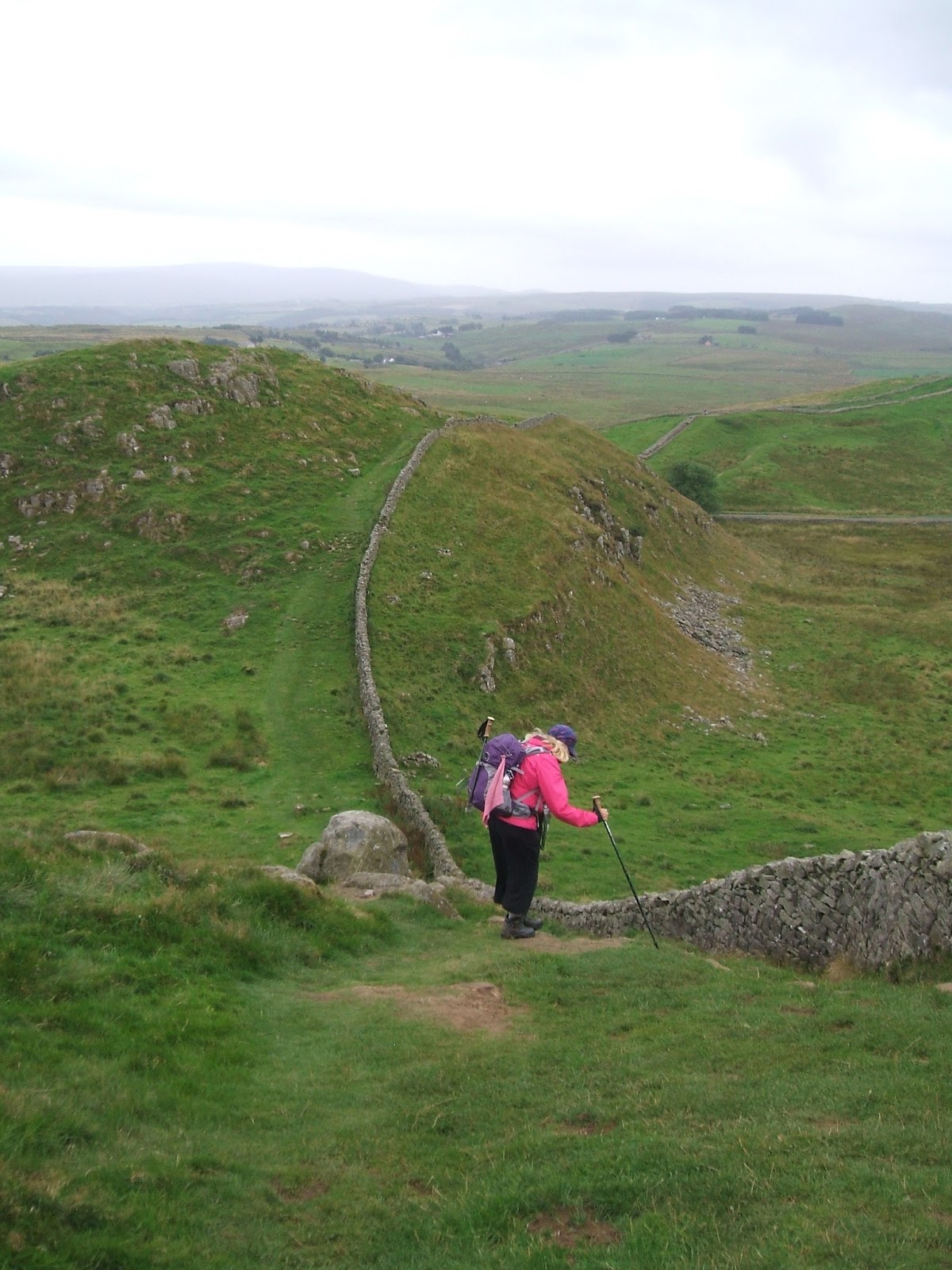
Kellah to Alston (August 2013)
13 miles
Weather: cloudy, sunny intervals, showers, cleared by evening
A good breakfast at Kellah B&B to set us up for the day. We rejoined the Pennine Way to begin but we immediately went wrong! We turned left too soon after Batey Shield and walked down a deep clough which we then had to clamber out of - very embarrassing. After twenty minutes we were back on the right track and trudged over a boggy moor with a slight detour to avoid cows. At Lambley we followed the path under the impressive Lambley Viaduct and then we were on the South Tyne Trail to Slaggyford and beyond.
A scenic walk with woodland, the River Tyne and occasional glimpses of the moors which were looking their best with the purple heather on display. During this stage the path runs parallel with the A689 and the Pennine Way. At Burnstones we stopped for lunch, At Slaggyford,which was once a thriving centre for nail making, we left the South Tyne Trail and rejoined the Pennine Way. By this stage Mrs C was very tired after a poor night's sleep and suffering from a blistered heel.I knew we were approaching the South Tynedale Railway and I thought that maybe she could hitch a ride to Alston. At this exact moment a father and son appeared on the path. We chatted, as you do, and they told us they were waiting for the train to depart at the station - bingo! Quicker than you can say, "Narrow gauge railway", I had Mrs C installed on the train, fair paid and ticket clutched, rattling along in a carriage off to Alston. I waved her off and continued with the walk.
At this point the official route continues along the Pennine Way to Alston - 5 1/2 miles. The easier, shorter route was 4 miles alongside the railway. I took the easier option as it was quicker and cow free. A pleasant walk - I had the river on one side, with bridges to cross, birds to look at. I saw a fallow deer scamper over the railway line as the train was coming along. I arrived in Alston as a shower passed overhead. I visited the town hall and a helpful lady gave me directions to our B&B Greycroft B&B. Jane was already installed when I arrived and resting. I had tea and homemade cake with our landlady in the lounge. A shower, a change of clothes and we headed out for dinner at Alston House where we had a tasty meal.
A journal detailing Wainwright's 'Pennine Journey' - 247 miles (see http://www.penninejourney.org.uk for further details about this long distance path)
About Me
- Wandering Wayfarer
- I have always loved walking and as a child growing up in inner city Manchester I always relished the chance to escape to the Pennines and beyond. Although I now live in a semi rural area, I still like to take to the hills for a week or two weeks each summer and be surrounded by moors and fells and peace.
Sunday, 15 September 2013
Day 11
Once Brewed to Kellah (August 2013)
13 miles
Weather - cloudy to start, clearing later with sunny intervals and a warm breeze
On the trail by 9:00am and just us on the path. This section is very up and very down so my trusty stick came in very handy today. Windshield Crags came and went and we were buzzed by fighter jets. As the morning progressed we met more walkers who were all very happy to chat. We met a couple from Cannock who were bikers. We met the Italians again - the young lady was not feeling so good and was planning to catch the bus at Greenhead. Her partner was looking super stylish with his mini-sou'wester hat. We stopped at Cawfield Crags to use the handy loos and then before we knew it we reached Walltown Crags where we had lunch. There were toilets (spoilt today) and a shop selling tea, ices-cream, sandwiches, gifts, postcards and blister plasters (they know their market). We took the opportunity to buy and write postcards whilst enjoying a cup of tea. The very kind lady running the shop said she would post the cards - a lovely lady and a lovely place.
Next on the trail was a romantic ruin - Thirlwall Castle. This was closely followed by a walk into Greenhead via a path flanked by a river, railway and wild raspberries. At Greenhead we left the Hadrian's Wall Trail and had to negotiate crossing the fast and furious A69. We waited for a lull in the traffic and scuttled over accompanied by a friendly wave and blow of a horn from a lorry driver. Up an embankment to a stile and our first encounter with a Pennine Journey waymarker. The next section was vague. We were looking for a ladder stile, half right at the end of a row of Hawthornes. We eventually found it after wading through long marsh grass and tussocks with no discernible track.
For the next section of the trail we re-joined the Pennine Way which I do not think we had encountered since Tan Hill last year. It was all going very well for five minutes, then we saw the cows, then we saw the calves and finally we saw the bull. They were all stood on the path ahead between us and the next stile.
Now, usually bulls in fields with cows and calves do not take an interest in walkers. This one was very interested. He stood on the path and turned to look at us with his mean, beady eyes and his nose ring glinting. Mrs C and I had the same thought - we looked at each other, looked at the bull and decided that this bull would not let us pass without a fight. There was not a way round - this was a very large field. We turned about and headed purposefully back to the last stile - let us call it a dignified retreat. At a safe distance we consulted the map. There did not seem to be any paths or routes to take us round this field so we decided to head back towards Greenhead to the hamlet of Bankhope and follow the minor roads to Kellah. This was an interesting walk along a neglected, little used path. There was a steep decent into Bankhope via negoiating a fallen tree across the path. We were looking for the minor road to Kellah and asked two very kind gentlemen who were happy to help and gave us clear instructions whilst saying, "You're walking! All the way to Kellah?". We paused at Bleckinsop Castle which is a ruined castle and, by the way, is up for sale for £1.75m. We then found the road and yomped along it for 2 1/2 miles to our next B&B at Kellah. Obviously my 2p offering to the god Mithras, The Bull God, was not enough. It should have been at least a goat sacrifice to make sure the path was clear of bulls across Bleckinsop Common.
We arrived at Kellah B&B at 6:00pm and had tea and biscuits in the lounge with our landlady and two other guests, a farmer and his wife from Cork, Ireland. We had dinner at the Greenhead Hotel - lovely meal and friendly staff.
Day 10
Walwick to Once Brewed (August 2013)
12 miles
Weather: Strong westerly wind (17 mph), sunny intervals, slight rain showers
Oh the pure joy of waking up on a Monday morning and knowing you do not have to get up and go to work. The sheer pleasure of a week full of walking with a good friend in a glorious place.
We enjoyed a tasty, filling breakfast with homemade jam and home grown tomatoes. We met a young Italian couple at breakfast who are walking Hadrian's Wall and followed by the West Highland Way.
We were soon back on the trail with memories, for me, of 2004. Broccolita Fort and the Mithras temple all present and correct. I left a votive offering at the temple - a whole 2p. There were lots of people out walking today on this very popular trail so lots of "hellos", "good mornings", "isn't it windy!" comments. The wall was very much in evidence today along with the vallum and ditch and the ever present military road. We had fantastic views in all directions with high, scudding clouds above us. We stopped for lunch and met a volunteer path warden. He has a 3km stretch to take care of and we walked along with him for a short time. He shared lots of interesting snippets about the history of the wall.
We tramped past mile castles and turrets today which I loved - I do enjoy a ruin. Housesteads was busy and we walked on by - it's not free and the toilets were miles way! Our next major milestone was the junction with the Pennine Way at Rapishaw Gap - happy memories for Mrs C. I am very glad to report on this trip I did see and admire the Sycamore tree at Sycamore Gap. I completely failed to look at it on my last trip as I was v. tired after a very long 18 mile day...so this time we stopped and took photos. The excitement today was increased by seeing an adder on the path. I just managed to get the camera out in time and take a snap -a beautiful creature.
We arrived at Once Brewed Youth Hostel at 4:00pm just as reception was opening. Showers, dinner booked, laundry done and journal written up - we are a well oiled machine when it comes to the end of a day's walking. We had dinner at the hostel which was grim - my fresh fruit salad was from a tin.... We toddled off to the Twice Brewed pub which was buzzing with walkers, including the Italian couple we met at the B&B, cyclists, diners and day trippers . A lovely, sociable end to a very enjoyable day.
Day 9
Hexham to Walwick (August 2013)
6 miles
Weather: Sunshine and some cloud, warm
Our trains arrived on time in Hexham for the start of the second leg of our Pennine Journey. My train travelling via the east coast line and Mrs C's; the west coast. Hugs and welcomes at the station then into town for a late lunch before we started walking. We found a lovely Greek cafe where we chatted and checked the maps. We left Hexham in sunshine and hoped this was a sign of things to come after the very wet conditions of last year's walk.
| River Tyne |
We crossed the River Tyne over a fine bridge designed by Robert Mylne and then we were off into the hills towards Hadrian's Wall. We ambled through the village of Accomb with it's water pump, 2 pubs and handsome stone houses. An Alpaca farm was passed and we were eyed suspiciously by a flock of Alpacas; large and small. Then, there it was, our first view of the wall at Plane Trees. Our path was now following the Hadrian's Wall National Trail.. This had been my first long distance walk in 2004 - a walk I thoroughly enjoyed - even the first section through Newcastle which some people tend to be a bit sniffy about. We had a pleasant stroll through a woodland and then a not so pleasant walk along a busy road. The River Tyne was crossed again at Chollerford via another very fine structure by Mr Mylne. It is a splendid bridge with a view down to the remains of the old Roman Bridge. A left turn past Chesters Fort and a walk by a very grand entrance to a stately pile with lions and box hedging in intricate patterns. We found out later that this was the home of the founder of the Sage software. We ascended Lincoln Hill and enjoyed an Eccles cake sat on a conveniently placed bench.
| The Secret Garden |
Before we had time to say, "Pennine Journey" we had arrived at our first B&B of the trip, East House. What a beautiful place! It is an early Victorian, stone built house with the most amazing walled garden. We had tea and cake in the wonderful greenhouse, with vines and figs lining the walls, whilst looking out over an orchard, vegetable garden, herbaceous borders, yew hedges and a rose garden. There was even a garden wall with a door - I was besides myself with joy. Our hosts were very welcoming and our room was comfortable with an orginal fireplace to admire. And so to bed dreaming of secret gardens with mysterious doors to venture through....
| The Dovecot at East House, Walwick |
Monday, 4 February 2013
Day 8
Blanchland to Hexham (July 2012)
11 3/4 miles
Weather: overcast, warm with sunny intervals
Another super breakfast and then fond farewells to our lovely hosts who dropped us off in Blanchland for the day's walk to Hexham. We followed a road out of the village which soon became a track and we passed an old lead mining village called Shildon. This used to be a drovers' route between Blanchland and Hexham. Up on the hill to the right we saw a former coaching house called Pennypie House. We had great views now as we walked along a good path across a heather moor with blue skies above us and Derwent Reservoir in the valley away on our right. We surveyed the moors, the sky and the valley once more before we plunged into the green quietness of Slaley Forest. We followed the forest roads and paths and eventually we emerged by Devil's Water and followed soggy paths towards Hexham. The paths were so water logged we disturbed toads who were wallowing in the puddles. There were more people about now as we neared civilisation. Around us we saw evidence of this area's lead mining past - the ruins of houses, works and the most beautiful pair of Gothic arches appeared round a bend (the remains of an old smelting mill). We walked through fields and sat a while on a bench placed in a perfect spot to take in the views. The seat was a memorial to a local hiking club leader.
Now we could see the abbey in the distance - not far to Hexham now. We entered the town - our first real town since Settle at the start, and made our way to the nearest tea room where we enjoyed a cup of tea and a comfort break. The tea shop was ideally situated for the tourist information office and a retail opportunity. After our brew we wandered into the town centre to have a look at the abbey which is beautiful. Originally built in AD900, it has some interesting artifacts including Roman tombstones (Hadrian's Wall is very close). The crypt was closed as it was late afternoon but after hovering about the entrance for a couple of minutes one of the guides opened it up for us and we descended into the gloom of the undercroft. It was marvellous - the crypt is part of the original 9th century abbey and you could feel the age of the place - stunning. We ascended the steps back into the light and the 21st century and found ourselves a wine bar with tables and chairs outside which were inviting us to sit a spell and benefit from the warmth of the late afternoon sunshine. We joined some locals and enjoyed an end of walk celebratory drink or three. The locals were very welcoming. We met a couple of girls who owned a beauty salon and and had just finished for the day, an old chap with a beautiful walking stick/crook which he had carved himself and a lady from Newcastle who was keen to hear all about our walking adventures. We hope we inspired her to go walking.
So, the last day for us on the Pennine Journey but we intend to be back in the new year for the next 5 day section - Hexham to Appleby. As our train pulled out of Hexham station we reflected on our wonderful, hard, interesting, soggy 106 mile walk and before the journey was over we had started our plans for the next stage...
Sunday, 13 January 2013
Day 7
Westgate to Blanchland (July 2012)
10 3/4 miles
Weather -Warm sunshine
We had an excellent night's sleep and a splendid breakfast - our hosts were wonderful - and, best of all, we are staying here again tonight! I went out to see the sheep and share some toast with them (by the way - bread was homemade and delicious). I also thanked the chickens for the tasty eggs. Now, today's walk. Weardale was new territory for me and so I was excited about walking here. Behind the house the moor we should have walked over yesterday looked incredible - remote, stark, bleak, boggy, bliss.
We followed the path out of town and we were soon on The Weardale Way which was our host path for part of today's trek. It was a steep climb out of Westgate and, for once, the sun was shining. We reached the top of the valley and paused to look back over the town and further to the far side of the Weardale Valley where we could still see our B&B. Our hosts had promised to look out for us so we gave them a big wave as we crested the hill and disappeared.
We skirted Height Quarry - a working quarry - and then we heard gun shots. We rounded a bend in the path and laid out below and to the right of us was a line of men with shot guns and dogs. I think they were hunting rabbits. They saw us, they all stopped walking, called back their dogs and waited until we had passed round the next bend. So glad they were vigilant and organised! We followed a track which passed through a boggy redundant railway cutting and we descended the hill via Smailsburn to Rookhope. So far the scenery had been majestic - an industrial landscape full of quarries, mine workings, old rail routes, tram ways, moors, ruined buildings, blue skies,Green grass and no rain. It continued in this vein all day.
We decided to take advantage of a tea and cake opportunity in the mining village called Rookhope. We enjoyed a refreshing cuppa sat outside a pub and I'm glad we did as next we had to climb Bolt's Law Incline. We were now deep in Lead mining country and this was a track going 600 feet straight up along the Sustrans C2C cycle trail. All was fine until we reached the summit and then misread the instructions and missed a path. We continued along the main track and realised after 20 minutes we had gone awry. We retraced our steps and found what we thought was the right path but soon realised it was not. The path soon fizzled out and we found ourselves doing acrobatics and tussock hopping along a very, very juicy non existent path. We could see where we needed to be - two old lead mining chimneys in the distance but to get to them we had to cross a very boggy, wet, section of moorland. We followed a fence with the idea that it must eventually hit and a path. Well it almost did. Eventually we were back on the official route via some fence climbing, grouse scaring, swearing and a feeling of slight panic. At least it was a sunny day and we could see where we wanted to be but even now looking back at the maps I cannot see where we went wrong! Back on track we walked between the two chimneys and down the hill towards Ramshaw. Again this path was indistinct and extremely wet and boggy: basically the whole hill seemed to be a river and we were wading through it and this time we were scattering rabbits in all directions.
We eventually reached Blanchland which AW waxed lyrical about on his original walk. The tea room was still open and so, of course, we took advantage. Our Host from the B&B came to pick us up and drove us back for our second night's stay - very few B&B's round here. When we arrived back at the B&B a drink was offered, we were expecting tea but instead we gratefully accepted Gin and Tonics - Colonial style. We enjoyed them sat in the summerhouse and watched the sun go down - Cheers!
10 3/4 miles
Weather -Warm sunshine
We had an excellent night's sleep and a splendid breakfast - our hosts were wonderful - and, best of all, we are staying here again tonight! I went out to see the sheep and share some toast with them (by the way - bread was homemade and delicious). I also thanked the chickens for the tasty eggs. Now, today's walk. Weardale was new territory for me and so I was excited about walking here. Behind the house the moor we should have walked over yesterday looked incredible - remote, stark, bleak, boggy, bliss.
We followed the path out of town and we were soon on The Weardale Way which was our host path for part of today's trek. It was a steep climb out of Westgate and, for once, the sun was shining. We reached the top of the valley and paused to look back over the town and further to the far side of the Weardale Valley where we could still see our B&B. Our hosts had promised to look out for us so we gave them a big wave as we crested the hill and disappeared.
We skirted Height Quarry - a working quarry - and then we heard gun shots. We rounded a bend in the path and laid out below and to the right of us was a line of men with shot guns and dogs. I think they were hunting rabbits. They saw us, they all stopped walking, called back their dogs and waited until we had passed round the next bend. So glad they were vigilant and organised! We followed a track which passed through a boggy redundant railway cutting and we descended the hill via Smailsburn to Rookhope. So far the scenery had been majestic - an industrial landscape full of quarries, mine workings, old rail routes, tram ways, moors, ruined buildings, blue skies,Green grass and no rain. It continued in this vein all day.
We decided to take advantage of a tea and cake opportunity in the mining village called Rookhope. We enjoyed a refreshing cuppa sat outside a pub and I'm glad we did as next we had to climb Bolt's Law Incline. We were now deep in Lead mining country and this was a track going 600 feet straight up along the Sustrans C2C cycle trail. All was fine until we reached the summit and then misread the instructions and missed a path. We continued along the main track and realised after 20 minutes we had gone awry. We retraced our steps and found what we thought was the right path but soon realised it was not. The path soon fizzled out and we found ourselves doing acrobatics and tussock hopping along a very, very juicy non existent path. We could see where we needed to be - two old lead mining chimneys in the distance but to get to them we had to cross a very boggy, wet, section of moorland. We followed a fence with the idea that it must eventually hit and a path. Well it almost did. Eventually we were back on the official route via some fence climbing, grouse scaring, swearing and a feeling of slight panic. At least it was a sunny day and we could see where we wanted to be but even now looking back at the maps I cannot see where we went wrong! Back on track we walked between the two chimneys and down the hill towards Ramshaw. Again this path was indistinct and extremely wet and boggy: basically the whole hill seemed to be a river and we were wading through it and this time we were scattering rabbits in all directions.
We eventually reached Blanchland which AW waxed lyrical about on his original walk. The tea room was still open and so, of course, we took advantage. Our Host from the B&B came to pick us up and drove us back for our second night's stay - very few B&B's round here. When we arrived back at the B&B a drink was offered, we were expecting tea but instead we gratefully accepted Gin and Tonics - Colonial style. We enjoyed them sat in the summerhouse and watched the sun go down - Cheers!
Tuesday, 8 January 2013
Day 6
Middleton-in-Teesdale to Westgate-in-Weardale (July 2012)
12 3/4 miles
Weather - warm with sunny intervals and a glorious sunset
We started today's journey along the banks of the River Tees which was in full, rushing, gushing state. We toddled along an easy riverbank path through meadows and woodland with purple foxgloves, blue cranesbill, yellow buttercups and creamy meadowsweet as a flowery accompaniment. After passing Scoberry Bridge and Wynch Bridge (the world's first suspension bridge erected in 1830) we reached Low Force and it was magnificent with water raging over the rocks and boulders.Onwards and upwards past Holwick Head Bridge and we entered Upper Teesdale National Nature Reserve. The path was flanked by twisted, stunted Juniper trees as we approached the highlight of today's walk - High Force. If you haven't seen it you must go. We could hear it a long time before we saw it, then we could feel it through our feet and, finally, there it was in all its glory - a roaring, awe-inspring sight. By the way, being on the national trail we did not have to pay to view the falls. Then we were off again in to the wonderful countryside of Teesdale. We soon reached Cronkley Bridge and crossed the River Tees to strike off over the moors to Westgate.
This is where we went awry. We crossed the B6277 and searched for a footpath to Hanging Shaw. We eventually found it after having to retrace our steps along the road. However, the gate to the path was locked and there was no sign of a visible path across the meadow. We walked further along the B road and up a minor road to pass a school looking for where the path came out. We could not find it so I walked over to the school just as the children and their teacher were coming out into the playground carrying water pistols and washing up bowls full of water ready for a water fight. They were all v. excited as it was the last day of term. The teacher didn't know where Hanging Shaw was but the children did. So off we went but we still could not see the path, eventually we found a ladder stile -which didn't have a footpath sign, and then proceeded with difficulty through a field with horses, across another field towards a ruined barn to reach a locked gate. There then followed a frustrating time - ladder stiles with rungs removed, barbed wire along tops of locked gates, oodles of mud and cows. After two hours of not getting anywhere fast we decided to retreat as it was now 4 o'clock and we still had 8 or so miles to walk over very juicy moorland. We walked down a country road and eventually arrived back at the High Force Hotel where we thought we could have a drink and ring for a taxi. How wrong can you be? The pub was shut and the place was full of midges. Whilst we waited we met a guy who worked for the Roby Estate which owns the falls, the hotel and all the land and farms in the area. We related our woes to him and he said he would pass on our story to the estate managers. It seems the Roby Estate is very keen to have walkers passing through the area but many of the estate farm tenants are not. They are making their displeasure known by wilful neglect and vandalism of the footpaths, signs, stiles and gates. I must say I have never experienced anything like it. We knew we were on the right path more or less but the local farmers were making it very difficult.
Eventually the taxi came and drove us over the moor we were looking for earlier and deposited us at the most loveliest B&B I have ever stayed in - Hill House East in Westgate-in-Weardale. It was wonderful. Wood burning stove to place our boots besides, chickens laying eggs for our breakfast, beautiful views up and down Weardale and perfect hosts. Goodnight.
12 3/4 miles
Weather - warm with sunny intervals and a glorious sunset
We started today's journey along the banks of the River Tees which was in full, rushing, gushing state. We toddled along an easy riverbank path through meadows and woodland with purple foxgloves, blue cranesbill, yellow buttercups and creamy meadowsweet as a flowery accompaniment. After passing Scoberry Bridge and Wynch Bridge (the world's first suspension bridge erected in 1830) we reached Low Force and it was magnificent with water raging over the rocks and boulders.Onwards and upwards past Holwick Head Bridge and we entered Upper Teesdale National Nature Reserve. The path was flanked by twisted, stunted Juniper trees as we approached the highlight of today's walk - High Force. If you haven't seen it you must go. We could hear it a long time before we saw it, then we could feel it through our feet and, finally, there it was in all its glory - a roaring, awe-inspring sight. By the way, being on the national trail we did not have to pay to view the falls. Then we were off again in to the wonderful countryside of Teesdale. We soon reached Cronkley Bridge and crossed the River Tees to strike off over the moors to Westgate.
This is where we went awry. We crossed the B6277 and searched for a footpath to Hanging Shaw. We eventually found it after having to retrace our steps along the road. However, the gate to the path was locked and there was no sign of a visible path across the meadow. We walked further along the B road and up a minor road to pass a school looking for where the path came out. We could not find it so I walked over to the school just as the children and their teacher were coming out into the playground carrying water pistols and washing up bowls full of water ready for a water fight. They were all v. excited as it was the last day of term. The teacher didn't know where Hanging Shaw was but the children did. So off we went but we still could not see the path, eventually we found a ladder stile -which didn't have a footpath sign, and then proceeded with difficulty through a field with horses, across another field towards a ruined barn to reach a locked gate. There then followed a frustrating time - ladder stiles with rungs removed, barbed wire along tops of locked gates, oodles of mud and cows. After two hours of not getting anywhere fast we decided to retreat as it was now 4 o'clock and we still had 8 or so miles to walk over very juicy moorland. We walked down a country road and eventually arrived back at the High Force Hotel where we thought we could have a drink and ring for a taxi. How wrong can you be? The pub was shut and the place was full of midges. Whilst we waited we met a guy who worked for the Roby Estate which owns the falls, the hotel and all the land and farms in the area. We related our woes to him and he said he would pass on our story to the estate managers. It seems the Roby Estate is very keen to have walkers passing through the area but many of the estate farm tenants are not. They are making their displeasure known by wilful neglect and vandalism of the footpaths, signs, stiles and gates. I must say I have never experienced anything like it. We knew we were on the right path more or less but the local farmers were making it very difficult.
Eventually the taxi came and drove us over the moor we were looking for earlier and deposited us at the most loveliest B&B I have ever stayed in - Hill House East in Westgate-in-Weardale. It was wonderful. Wood burning stove to place our boots besides, chickens laying eggs for our breakfast, beautiful views up and down Weardale and perfect hosts. Goodnight.
Subscribe to:
Posts (Atom)